Summer is around the corner. For most people like us who live in Canada, spending summer time at home without going for a long trip is a kind of waste of time because aside from summer holiday where children are break from their school, the hot weather tempts people to do outdoor activities like camping, hiking, fishing, road trip or vacation.
For this year, our family planned for a trip to East Coast of Canada in Nova Scotia, PEI and New Brunswick. We have been dreaming to visit East Coast for a long time. Although it is less popular compared to Western part of Canada like British Columbia (Vancouver, Victoria, Whistler) and Alberta (Banff, Jasper, Calgary and Edmonton), the Eastern part of Canada is also beautiful and worth to visit.
Considering we only have just about a week to spend, we were unable to go road trip starting from Toronto to Eastern Canada since the distance between Toronto and Halifax itself is about 1,800 kilometers and it takes about 18 hours non-stop drive by car. As well, since we don’t want to depend on local tour to travel from one place to the others, we need a car to move around places to visit in Eastern Canada. Thus, we decided to fly from Toronto to Halifax. The plan is we would rent a car from Halifax airport and return the car at Moncton airport where we would go back to Toronto from Moncton by plane.
With a limited time, we can only visit the most popular tourist destinations though. During our trip from August 13 to August 20, 2024, we visited Halifax, Peggy’s Cove, Mahone Bay, Lunenberg, Cabot Trails (all of them in Nova Scotia), Charlottetown and Cavendish in PEI; and Hopewell Rocks and Moncton in New Brunswick.
Table of Contents
First Day - From Toronto to Halifax
Booking a flight from Toronto to East Coast need a little more research since only certain airlines serve it. The biggest airport at East Coast is of course, Halifax Stanfield International Airport. The airport in Moncton and Charlottetown are much smaller than Halifax airport. As such, there are more airlines and more flight trips per day that serve between Toronto and Halifax. We initially wanted to land in and then return back from Halifax. However, since we do not want to miss the late morning flight from Halifax on our last day (where we would need to drive from Moncton directly to Halifax airport, as our last place to visit is Hopewell Rock close to Moncton), we decided to stay our last night at Moncton and return back to Toronto from Moncton airport.
With less than a month to go before our first day trip on August 13, we booked a one-way Air Transat flight to Halifax. The flight departed from Toronto Pearson airport at 10:05 am EST (Eastern Time) and would arrive at Halifax Stanfield airport at 1:13 pm AT (Atlantic Time). AT is one hour ahead of EST. As such the estimated travel time is 2 hours 8 minutes.
When we made the reservation for Air Transat, we just realized that this flight is operated by Porter Airlines. We compared the ticket price between Air Transat (from Air Transat’s website) and Porter (from Porter’s website) and we noted for the same date/time and same economy class the price is more or less the same. However, when we checked what included in the price, we noticed that Air Transat booking included one free checked baggage, one free carry-on and one free personal item. However, the Porter booking (from Porter website) includes only one free carry-on and one free personal item. There is an additional fee to pay for every checked baggage. Because of this we of course booked the flight through Air Transat website.
When we arrived at Porter’s cabin, we realized that this Porter flight only has window and aisle seat without any middle seat because the seat setting inside the plane is two seats at the left and two seats at the right side of it.
Picking up rental car and got surprises
We arrived at Halifax airport at around 1:20 pm. While my wife was waiting for our checked baggage, my son and I went to the car rental booth inside the airport to pick up our rented car at Enterprise Car rental.
When we arrived there, we lined up for about 15 minutes because there were four people in front of us. When we were served by the attendant, they said we needed to wait for about 20 minutes because the car was not ready yet and was still being cleaned. I mentioned to the attendant that I would like to include one additional driver (which is my son) as a second driver to the rental agreement. He asked for my son’s diver license information and said I needed to pay extra $10/day for this. I said I am okay with that. For information, we reserved the cheapest car which is standard vehicle like Toyota Corolla or VW Jetta because we only have three passengers.
After about 30 minutes without being called, I asked the same attendant about my car. He said my car was not ready yet and I still needed to wait for another 15 minutes. He said since I would have to wait for a long time, he offered a $100 discount on my rent price. He further stated he would give me the first car to arrive whatever it was. After waiting for 20 minutes (for a total wait time of 50 minutes), I got my car. Since there was no standard car available, I got upgraded to standard SUV car which is KIA Sportage. The odometer reading when I picked up the car is 13,217 kilometers. The car condition is still good. I guessed the age is less than a year.

I said to myself, thanks God after waiting for 50 minutes, even though I was a little bit inpatient at first, I got a $100 discount and an upgraded car without paying additional cost. Later on, I was thankful that I got SUV because the driving along Cabot Trail is much easier if I drive SUV than standard car.
To Peggy's Cove Lighthouse in the afternoon
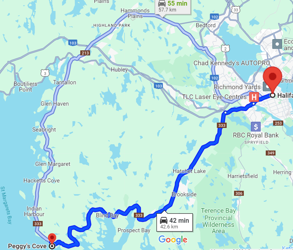
After having our late lunch close to our hotel in Halifax, we checked in at our hotel and took a rest/nap for an hour. Our plan that afternoon was to go to Peggy’s Cove. From Google Maps, the distance between our hotel to Peggy’s Cove is 43 km and a 42 minutes drive by car.
Peggy’s Cove is a 206-year-old active fishing village and home to the iconic Peggy’s Point Lighthouse. Over there, you can witness the power of the sea, immerse in the natural landscape, experience the sights and sounds of the village and enjoy the scenery around Peggy’s Point Lighthouse.
Peggy’s Cove is located at southwest of Halifax and at south shore of Nova Scotia. The easiest and fastest way to drive to Peggy’s Cove from Halifax is through Nova Scotia Route 333 (NS-333) highway clockwise. NS-333 highway has only one lane per direction and there is no divider/barrier placed between the lanes to divide traffic moving in opposite direction. The speed limit of NS-333 is mostly 70 km/hour. After about half way drive at Shad Bay, the road becomes bend making sharp curve to the left and right. In some area, the road bends and turns at more than 180 degrees. Although the driving condition became more difficult, the route between Shad Bay and Peggy’s Cove is very scenic because of passing many beautiful lakes on the left side of the road. It took us just about one hour to arrive at Peggy’s Cove at 6:30 pm.
The main road to access Peggy’s Cove is Peggy’s Point Road. It is an asphalt road of less than one kilometer length. There is an information center on the left side of the road half way to the Peggy’s Point Lighthouse. Over there you can find information about Peggy’s Cove and other tourist locations in Nova Scotia. Although there are parking spaces over there, I parked my car at the larger parking area at the top of the hill closer to the Peggy’s Point Lighthouse.
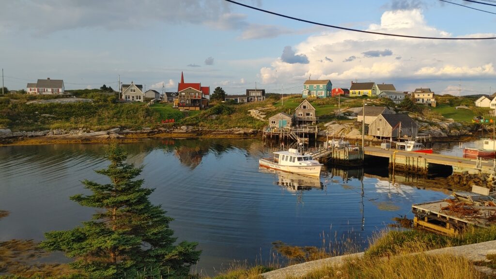
On the way to the lighthouse, you can view and take a picture of St. John’s Anglican church, a historic gothic style building located on the right side of Peggy’s Point Road as well as the picturesque and famous Peggy’s Cove fishing village. There are two main seafood restaurants: Tom’s Lobster Shack, a smaller one located half way to the end and Sou’ Wester, a bigger one with souvenir shop located closest to Peggy’s Point Lighthouse.
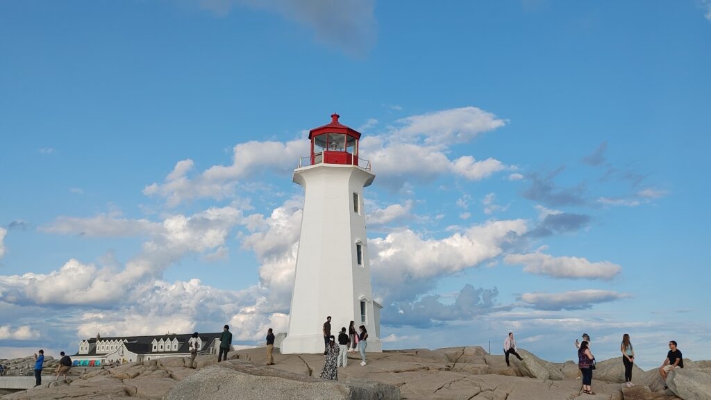
Peggy’s Point Lighthouse is one of Nova Scotia’s most well-known lighthouses and may be one of the most photographed in Canada. The lighthouse is located on a barren rock at the entrance of St. Margaret’s Bay and is visible from many vantage points. It perches atop of massive smooth granite by the pounding waves below. First constructed in 1868 made by reinforced concrete and steel. It has a shape of octagonal white tower with balcony and red lantern at 15 meter tall. The lighthouse is designated as a federal heritage building due to its historical, architectural and environment value.
We spent the evening watching the waves, exploring around the rocks and of course taking pictures of the lighthouse. We were lucky the weather at the time was partly cloudy, calm, warm with a little breeze making our experience enjoyable and unforgetable. If it is rainy or the waves are rogue spalshing the water up over the rocks and the rocks become wet, visitors are reminded to stay away from the rocks because it is dangerous.
We saw a lot of tourists there. Some of them relaxed by sitting down on many big cottage chairs on top of the rocks either doing sun bath, reading book, sleeping, watching the waves or just enjoying the scenery while waiting for the sun to set.
Since we were hungry, we decided to have our dinner at Sou’ Wester, one of the two seafood restautants in Peggy’s Cove. The main menu at the restautant are, as you may guest, lobster dinner, lobster roll, fish & chips, seafood platter and anything related to sea. We ordered fresh steamed lobster dinner, haddock dinner, fish & chips, and seafood chowder to share between us.

Before we left Peggy’s Cove at ariund 9:00 pm, we took several pictures of the lighthouse at night when the light of the lighthouse lit.
Second Day – Mahone Bay, Lunenberg and downtown Halifax
This morning, we needed to go to Enterprise Car Rental office to include my son as a second driver because the rental agreement I received by email did not include his name. Apparently, the Enterprise attendant at Halifax airport did not do their job well. Even though they scan my son’s driver license and assured me to include him as a second driver, they forgot to include him at last. The night before, I called Enterprise office at the airport but no one picked up the phone. I did not receive a call back for the message I left to them. I also called Enterprise customer service telling the situation and asking them to include my son as a second driver, they told me not to worry and they would include the second driver but they said they would get an approval from their manager first and said the manager would call me to confirm but they did not do it.
The attendant at the Enterprise office close to my hotel lastly helped me to include my son as a second driver. We spent additional one hour for this purpose.
The plan for today was going to spend sometime and having lunch at Lunenberg and just stop by Mahone Bay on the way there and going to downtown Halifax in the evening. We set our destination on Google Maps to Mahone Bay. It is 78 km far and 48 minutes drive from the Enterprise’s office.
Mahone Bay
Google Maps guided us to go via Nova Scotia Highway 103 (NS-103) to Mahone Bay. NS-103 is an east-west Highway in Nova Scotia that runs 291 km from Halifax along south shore region fronting Atlantic coast all the way to Yarmouth in the west. In the first 33 km from Halifax the highway is 4-lane (2 from each direction) divided highway. After this, the highway becomes 2-lane (one from each direction) undivided with no barrier in between. I noticed that the drivers in Halifax are mostly following the rule. In the 4-lane highway, the left lane is only used for passing. After they pass it, they change lane to the right.
When we arrived at Mahone Bay at about 10:30 am, we visited Mahone Bay Information Centre to get brochures, maps and information about Mahone and Lunenberg from the attendant. The girl over there is very friendly and explained and answered questions we asked.
Mahone Bay is a small town situated on the northwest shore of Mahone Bay along Nova Scotia’s beautiful south shore which offers a rich tapestry of natural beauty, culture and heritage. Famous for the Three Churches (St James Anglican, St John’s Lutheran and Trinity United), Mahone Bay has become an iconic image frequently photographed and featured on postcards, calendars and picture magnets. The three prominent churches are best viewed from across Mahone harbour where they cast their reflection on the peaceful bay.
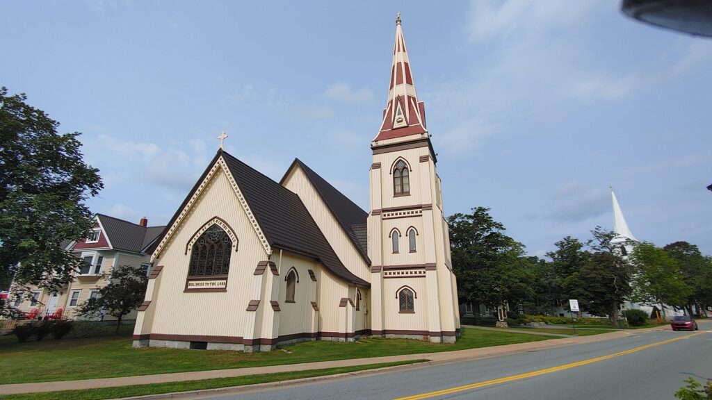
The unique shops along with the colorful and quaint streets make Mahone Bay a perfect getaway for those seeking a unique maritime experience. Recently, Mahone Bay was named as one of Canada’s top beautiful towns.
We spent about an hour to take pictures, enjoy the scenery, stroll along the bay, relax on the bench and ponder about how beautiful Mahone Bay is, before we continued our trip to Lunenberg.
Lunenberg
Lunenberg, an hour drive from Halifax, is an old town and a beautiful fishing village located at southwest Halifax on south shore of Nova Scotia. The town was designated by UNESCO in 1995 as a World Heritage Site since the site and the colorful wooden natural architecture retains its original layout and appearance since 1800s.
Lunenberg’s economy relied on the offshore fishery historically. Today, Lunenberg is home to one of Canada’s largest processing plants. You may not know that the famous High Liner staple frozen seafood products (fish, shrimp etc.) where you can find from at grocery stores has its head quarter in Lunenberg.
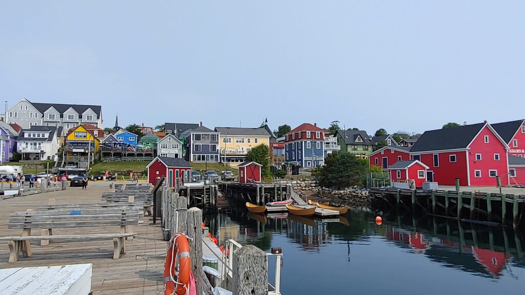
We arrived at Lunenberg at 11:30 am. We went to the famous boardwalk at the shore of Lunenberg town. Because it is summer time, I saw a lot of tourists walking, taking pictures, shopping or just sitting on the many benches (cottage chairs) enjoying the scenery and talking to each other. I noticed that most of the tourists at Lunenberg are elderly or at least middle up and 80% of them are Caucasian. It makes sense probably because people who enjoy history and old town are elderly.
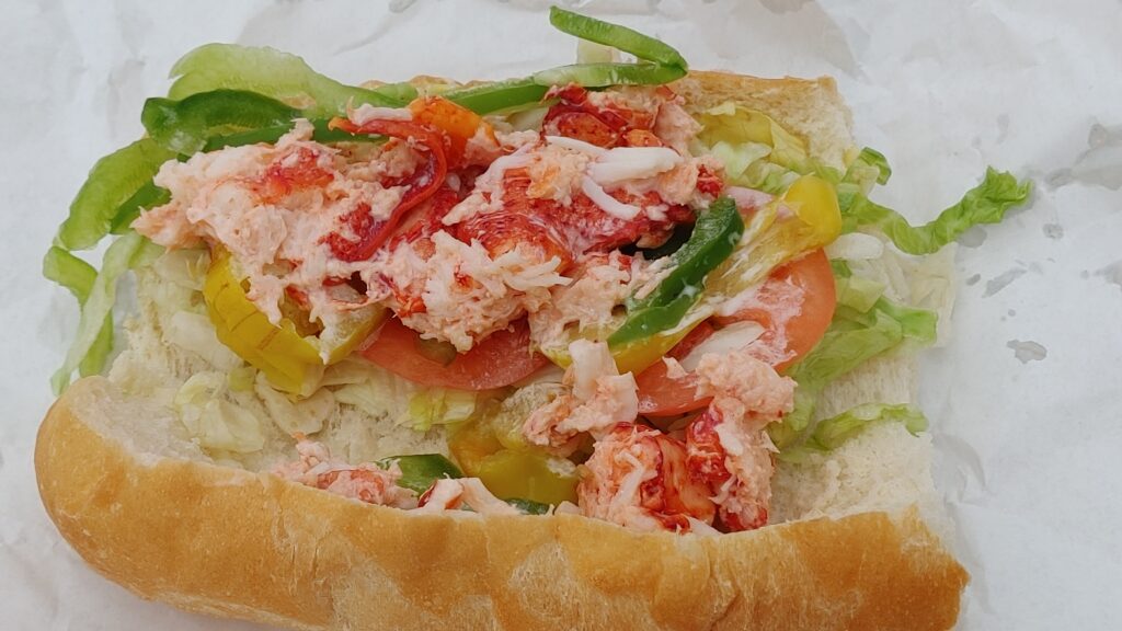
After enjoying the scenery and relaxing there, we had our lunch at Subway fast food restaurant where they sell a special sub which we can only find there: sub with 100% Atlantic Canadian lobster. When I ordered the sub at the counter, as usual, after choosing the toppings and veggies we usually choose the sauces. I said I wanted to add sweet onion teriyaki sauce (my favourite sauce) into it. The server paused and then asked me if I ever eat lobster. I was surprise with this question but then realized that this may not be a good combo. I then said its okay, no sauce. She said yes, and politely say “please don’t do it, that will spoil the lobster’s taste”. I was ashamed a bit with her comment due to my innocence. This may be one of the memorable things I will never forget. For information, I eats lobster many times in Toronto, but the lobster I bought are mostly steamed lobster. I never eat lobster sandwich like that before.
The Subway store there is backing the Lunenberg shore and located at higher elevation than the shore. We ate at the outdoor patio behind the store. From the patio we can see the scenery of the shore below. The weather at that time was pretty warm and relaxing making our time there enjoyable. If not because we wanted to go to Halifax lakeshore thereafter, we would like to spend more time sitting and talking while enjoying the view from above. I saw there are few people reading book after finishing their subs at the patio.
Halifax
After having some rest, we left our hotel at 5:00 pm to go downtown Halifax. The plan was to spend our evening at Halifax waterfront. According to Google, the distance is only 10 km and the travel time to the parking lot closest to the waterfront is 28 minutes. Because our hotel is located at west end of Halifax, Google suggested to take Nova Scotia Trunk 3 (NS-3) which is called St. Margarets Bay Road in Halifax. Actually, NS-3 is an east-west trunk highway in Nova Scotia which route runs along the south shore from Yarmouth at the west to Halifax in the east and end at Armdale Roundabout in Halifax.
Roundabout Nightmare
Armdale Roundabout is about 5 km from our hotel, half way distance to the waterfront. I live in Toronto most of my time and I am not accustomed to drive passing roundabouts because there is none in Toronto. I know there are some roundabouts in Toronto nearby towns. I always confuse and am not confident entering it. What I know is, we have to drive counter-clockwise.
Here is a little information about Armdale roundabout. The traffic at Armdale roundabout receives vehicles from five different directions. On average, the roundabout handles approximately 60,000 vehicles on weekdays. This roundabout has 2 lanes 80% of it and in one section it becomes 3 lanes.
I drove from west end going to downtown Halifax during the busy afternoon rush hour where people were going back from their work. As such, the traffic coming from the opposite side of the road is much higher than on my direction. When I started approaching Armdale roundabout, as usual I have to stop to yield to the traffic coming from the left side because traffic in the roundabout has the right-of-way.
Google told me to enter the roundabout and exit at the third exit. I stopped at the yield sign and waited until the traffic from the left is empty to make sure I have a safe gap to enter. Guess what happened! Because the traffics from the other direction are very heavy, the vehicles coming from my left side never stop. I was panic a bit. How could I enter the roundabout? To make it worse, the vehicle behind me started honking at me.
My son who navigated me asked me to just enter the roundabout at faster speed by cutting vehicle from the left. I finally entered it safely without a knowledge whether what I did was legitimate or violating traffic rules. After I entered it, I was again confused as which lane I had to use, the left or right lane. Since I am not familiar with roundabout, I was not sure if I chose the wrong lane and kept going, I would end up either in the wrong direction or being hit by another vehicle. Later on, I knew that we need to know first which lane to enter in a multi lane roundabout before we enter it. Otherwise, we may not be able to exit to the road we want to go because we are not allowed to change lane (solid white lane divider between the lane) at roundabout.
My gut feeling told me to use the left lane and I followed it. I was wrong, because I had to exit at third exit. I ended up changing lane and crossing the solid white lane divider without any trouble even later on I knew I made a dangerous thing since the traffic was busy at the time.
My experience with roundabout is always bad. I did not know why city of Halifax uses roundabout in the busy intersection like that. What I know is roundabout is safe if the traffic is light like in smaller towns. However, Halifax Transportation’s website states that by installing a roundabout instead of a traffic signal or all-way stop, there are less delays on the commute. It can also improve fuel consumption and emission control as there will be less a chance people need to stop. Okay Halifax, that may be true if the traffics at the intersection is light. This is not true if the traffic is heavy like at Armdale roundabout! This is also not driver-friendly for people coming from cities that do not have roundabouts like Toronto. Anyway, this is just only my personal opinion!
Halifax's vibrant waterfront
On the way to the waterfront, we passed by Halifax Citadel on the right side. We arrived the parking lot at Lower Water Street closes to Bishop’s Landing and paid $9 for the parking. The parking rate is $3/hour. However, when I pressed for 3 hours, my parking expire time was extended to the following morning. Probably because it had been evening time.
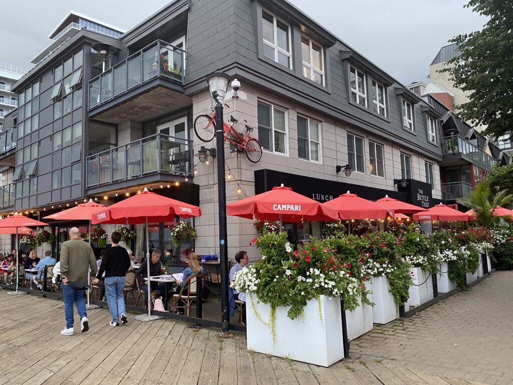
When I reached Halifax waterfront, I was surprise with how big and long the waterfront is. I checked from the website, Halifax wooden waterfront boardwalk is the longest one in Canada and is one of the longest in the world. This 4-kilometre broadwalk spans from the Canadian Museum of Immigration at Pier 21 at the south side to Casino Nova Scotia at the other side. It is one of the most-visited destinations in all of Nova Scotia. Along the broadwalk, you can explore museums, dine at waterfront restaurants, browse boutique shops, watch boats come and go, sit at patio watching the sun set over the harbour, take a ferry to Yarmouth and may more.
One of the interesting places at Halifax waterfront is Salt Yard. It is an open public space between Sackville and Salter Streets on the Halifax waterfront with over 30,000 square feet size. The area includes a cluster of 16 small businesses selling fast foods, souvenirs and arts, public seating, space for entertainers and performances.
You can find famous street food vendors at Salt Yard, such as Smoke’s Poutinerie, Waterfront Pizza and Wrap, the famous Cows ice cream, Caffee Lucca, Masita Korean Food selling ramen, Dave’s Lobster, and off course my favourite Beaver Tail.
We bought one bacon poutine from Smoke’s Poutinerie, one donair from Waterfront Pizza and Wrap, one Triple-Trip Baver Tail and Cows ice cream to share. I just learnt that donair is very famous and can be found anywhere in Halifax. This late-night favourite has become so popular that in 2015, Halifax city council voted to make it the city’s official food.
Donair is a pita filled with spit roasted shaved beef, served with tomatoes and onions and slathered with signature donair sauce. Almost every pizza store in Nova Scotia sells this sumptuous and sloppy late-night snack, some even selling more donairs than pizzas.
Not far from Salt Yard, you can find Maritime Museum of the Atlantic, a museum exploring region’s maritime past.
While strolling along the waterfront, we saw and took pictures of a luxury boat with a small helicopter on its rooftop, area of broadwalk where people can relax and sleep on hammocks, Georges Island with its lighthouse located at 300 metre in front of the waterfront, and Bishop’s Landing.
Bishop’s Landing is a complex at the south side of waterfront that offers exceptional shopping, dining and living space on the Halifax waterfront. In addition to restaurants, boutiques and local businesses, Bishop’s Landing also provides a 200 plus residential suites. The restaurants at Bishop’s Landing are more upscale than other restaurants located close to Salt Yard area.
Third Day - From Halifax to Cheticamp
We had our breakfast at our hotel in Halifax earlier at 7:30 am today because we wanted to travel to Cabot Trail in Cape Breton Island at northeast of Halifax. We would stay one night at Cheticamp, a small town on the Cabot Trail on the west coast of Cape Breton Island.
When we prepared our itinerary for our trip, we were debating our selves if we would circle Cabot Trail clockwise or counter-clockwise. Some people say travelling counter-clockwise is better because most beautiful sceneries are on the right side if you travel counter-clockwise and we can easily make a frequent stop at many lookouts on the right side. However, we decided to drive clockwise because we planned to hike the popular Skyline hiking trail in the evening of that day to see sun set.
According to Google Maps, the distance of Cheticamp is 398 km from our hotel and it took 4 hours 20 minutes driving time without stop. We left our hotel in Halifax at around 8:30 am. If we drive without stop, we could arrive at Cheticamp at 1:00 pm. Our plan is we would have our lunch at Cheticamp either at Mr. Chicken or Wabo’s Pizza, Sub and Donair. We knew that we would not be able to arrive at Cheticamp at 1:00 pm because we would stop at some places to take a short rest for either going to wash room or stretching our body and change the driver.
The potential stop places along the way to Cheticamp are McDonald at Lower Truro (km 110), Highland Square Mall at New Glasgow (km 158), McDonald at Antigonish (km 216) and Tim Horton at Whycocomagh (km 315). After this, there are no stop places other than visitor centre at Margaree Fork (km 363). We stopped at McDonald at Lower Truro to have washroom break and buy ice coffees. We bypassed New Glasglow and the next stop is another McDonald at Antigonish. From here, we changed the driver. The first segment of this trip was driven by my son. I drove the car from Antigonish all the way to Cheticamp.
The scenery along the NS-104 Trans Canada Highway between Truro and Antigonish is beautiful. The road are 4 lanes divided highway (2-lanes for each direction).
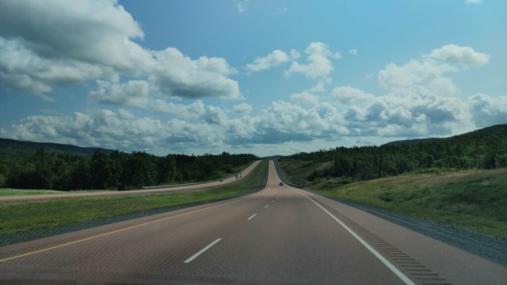
To go to Cape Breton Island, you need to drive through the Strait of Canso, the 1,385 m long Canso Causeway connecting the island with the mainland because the island is physically separated from Nova Scotia peninsula.
Okay, before I continue, let me tell you something about Cabot Trail.
Cabot Trail
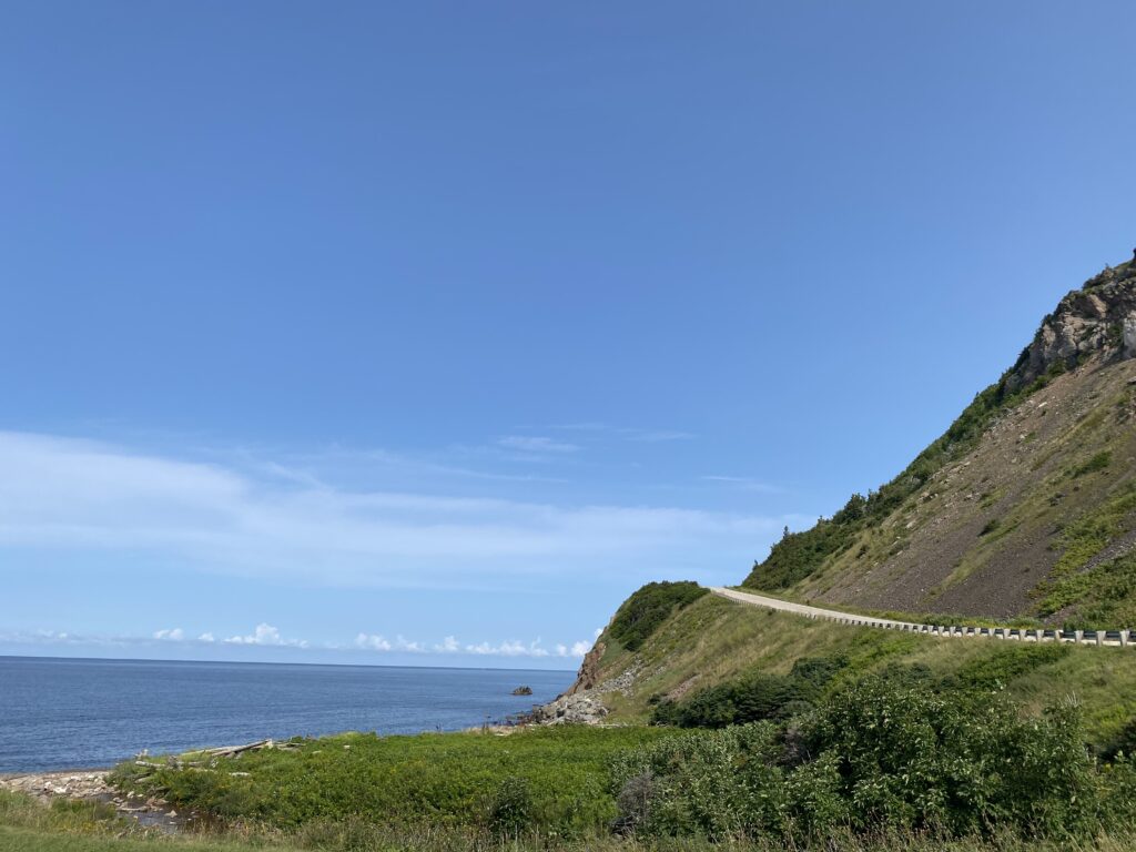
Cabot Trail, a scenic road circuit around and over Cape Breton Highlands National Park (at its northern part), is considered as one of the most famous scenic drives in Canada. This 298 km provincial highway rewards divers and travelers with the natural beauty and spectacular coastal views and valleys along the way.
Located at northwestern of Cape Breton Island, the route goes through coastal villages and mountaintop wilderness. Along the way, you will experience the hundred years of Scottish heritage, French Acadian culture and indigenous Mi’kmaq culture. Along the trail, you will have opportunities to hike, kayak, bike, whale watch in a dramatic East coast setting.
With over 400,000 visitors drive through Cabot Trail each year, in North America, the scenery of the trail and island is comparable by Newfoundland only.
After going through part of the two lanes road (one way each direction) that have many turns from Whyccomagh to Margaree Forks (NS-395) plus the heavy rain along that way, we stopped at first lookout at Cabot Trail at about 2:00 pm. Good thing, the rain already stopped and the weather is bright again. We then continued our journey to Mr. Chicken to have our lunch.
Lunch at Mr. Chicken
As the name say, Mr. Chicken is a fast food restaurant selling all kind of chicken products such as fried chicken, chicken burger, popcorn chicken, as well as potato fries and its famous ice cream.
We ordered a bucket of 14 pieces fried chicken for $36.99 plus one medium fries to share between the three of us. While we were there, there were few people enjoying the hot summer day eating chicken at many picnic tables in front of the restaurant, but none inside.
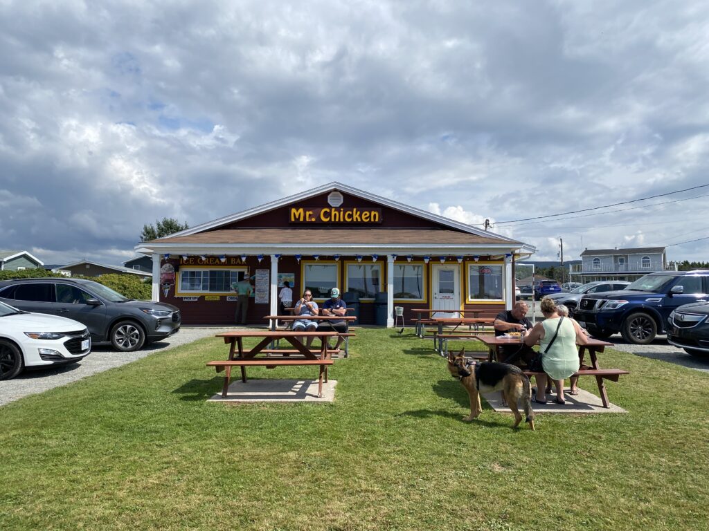
We sat inside the restaurant and waited for about 10 minutes to get our order. When we opened the bucket container, we noticed the fried chicken was much more than what we ordered. I told the server if she served me the wrong order. She replied that the person who prepared it gave me extra chicken. Curiously, I counted all the chicken. Surprisingly, there were 25 pieces all together. Since we could not finish them all at once, we packed them and brought back to our hotel for our dinner.
Cheticamp Visitor Center
After we finished our lunch at Mr. Chicken, we went to Cheticamp Visitor Centre located at the entrance of Cape Breton Highlands National Park. We asked information about Skyline Trail from the attendant over there. We told our plan that we wanted to go to Skyline Trail that evening, then go back to stay at our hotel at Cheticamp (outside Cape Breton National Park) and the next morning we would drive circling the national park from Cheticamp counter-clockwise to Ingonish and then Baddeck.
He said since Ingonish is the last town within Cape Breton National Park if we drive counter clockwise from Cheticamp, as long as we could leave Ingonish by 3:30 pm the following day, we only need to pay for one day pass to enter the National Park which is $17.50 for a family category fee. For information, the park pass for adult is $9.00 per day. After we picked some brochures and maps, we purchased the park pass for $17.50. The attendant said the receipt that show the expiry day and time need to be put inside the vehicle’s dash board to show we had paid the entrance fee.
We returned from the visitor center and checked in at our hotel at around 3:30 pm. Actually it is an inn because there are not many hotels in Cheticamp, most of them are either inns, chalets or bed and breakfasts. Because there are only few accommodation in Cheticamp and due to the busy summer time, the inn we stayed there is the most expensive accomodation per night we paid during our trip in East Coast. It is more expensive than the one we stayed at Halifax.
The Laurie’s Inn where we stayed is located on the main street of Cheticamp. It has three different buildings. The one closest to the street is the building for people to have their breakfast (breakfast is included in the hotel price). The other two are two-storey buildings are for guests to stay. Our room is located on the first floor but the building is facing the street and shore of Gulf of St. Lawrence. Because the building is located in hill that is few meters higher than ground level, we can see the view of the shore from our room.
Hiking at Skyline Trail at Cape Breton Highlands National Park
At 5:30 pm, we left our hotel to go to Skyline Trail at Cape Breton Highlands National Park which is located 21 km far from our hotel and it took 30 minutes because we drove slowly to enjoy the view.
We arrived at the Skyline Trail parking lot at 6:00 pm. We initially though it was late because the parking lot was half empty and people started leaving the trail. However, as I started parking our car, I saw people were still coming little by little.
Skyline is the most popular among a dozen of hiking trails at Cape Breton Highlands National Park. Many people visit it during the summer and fall seasons to enjoy the dramatic headland cliff’s view of the Cabot Trail. You have two ways when you want to hike at Skyline: loop trail of 8.2 km or return trail of 6.5 km. Most people take the return trail because it is shorter. Either way, you can reach the top of the hill where you can take picture on the famous wooden boardwalk with the cliff background or ocean view behind.
On the top of the hill, you can see a dramatic headland cliff overlooks the rugged coast. While feeling the breeze of wind you can have an eagle’s view of the Cabot Trail down the mountain. It makes the vehicles moving along the trail underneath look like toys.
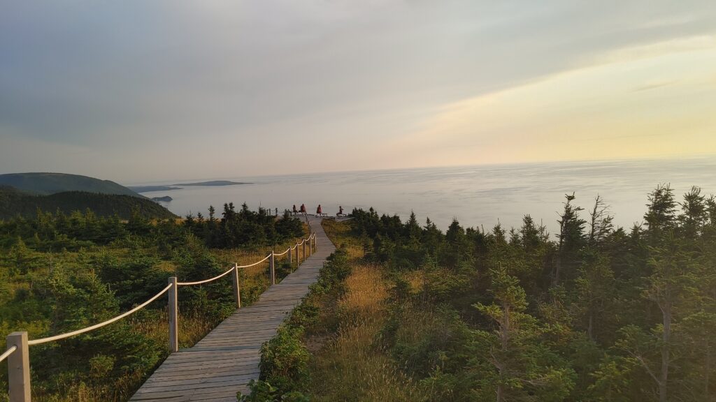
While we were hiking we saw many people were returning back from their hike. I though maybe we were a little bit late since it had already 6:30 pm. Surprisingly, when we reached the final destiantion, i.e., the top of the hill, I saw at least one hundred people were still staying there. Many of them sitting on the bench. Children were running and playing although the area is kind of dangerous because there are no barrier along the trail. I finally realized they were there to wait for the sun to set.
Since we also want to see the sun set, we spent the rest of the evening over there. I checked from Google the sun was to set at 8:13 pm. Although we have to wait for almost 2 hours, the time spent is worth because for us this is a once in a lifetime experience to see the panoramic view from top of the mountain and view the sun slowly set until disappear below ocean horizon. This is the most enjoyable moment at Skyline.
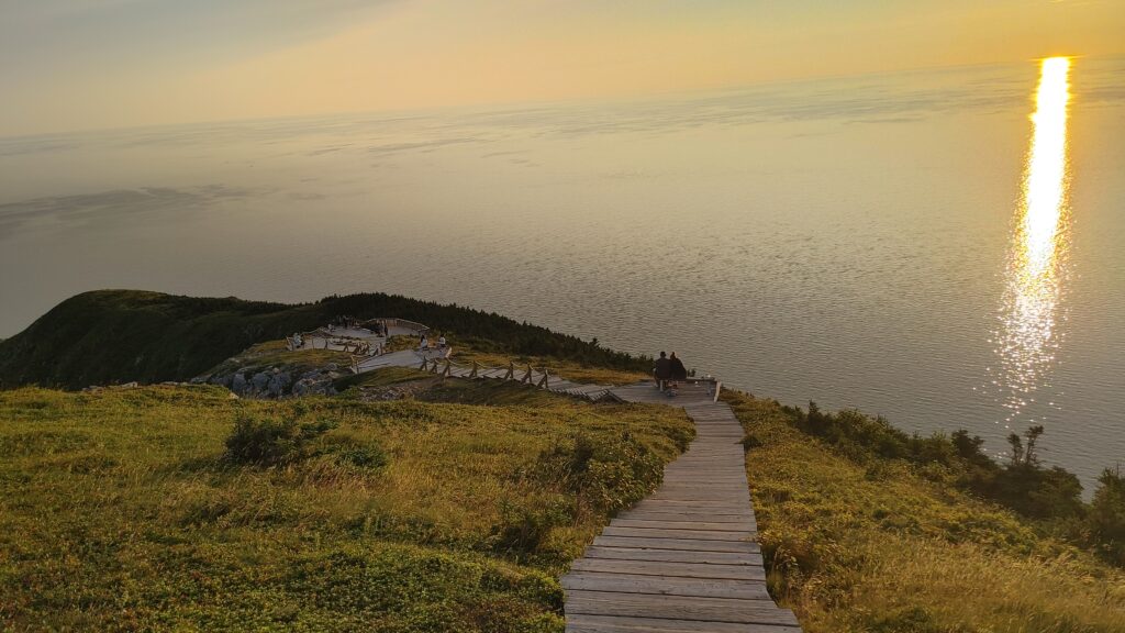
Once the sun set, people slowly returned back to the parking lot to go home. While we were walking back, the sky started to dark. Since we had to go through part of the forest with tall trees on the left and right, the moon light at the time is not enough to illuminate the hiking trail. Luckily, I brought one flashlight to brighten the way. My son used his cell phone flashlight instead.
We arrived at the hotel at 10:30 pm and we ate the leftover fried chicken we bought from Mr. Chicken.
Fourth Day - Circling Cabot Trail from Cheticamp to Baddeck
Initially our plan this morning is to have another hike at Le Buttereau or Le vieux chemin du Cap-Rough trailhead. The first hiking trail is 10 km far from our hotel and the other one is about 15 km. However, since we were too excited and too tired the night before while we hike at Skyline trail, we decided to skip both of them.
Instead, we drove slowly and stopped intermittently at certain spots along the main street to enjoy the picturesque beauty of the Acadian region of Cheticamp. We took picture the famous Paroisse Saint-Pierre church located in the village that overlooks Cheticamp harbour. This sandstone Canada’s Historical Catholic church with its central tower is a prominent structure which can be seen at some distance.
We also went to Co-op grocery store located in front of the church on the other side of the road. We bought snacks, water and cup noodles. The grocery store is surprisingly complete and huge. You can find almost anything over there.
Pleasant Bay
After spending about two hours at Cheticamp and bought pastries at the famous Aucoin La Boulangerie Bakery in Petit Etang, a small community not far from Cheticamp, we continued our road trip counter clockwise to Baddeck over circling Cape Breton Highlights National Park from the North. The first stop is Pleasant Bay, a community on western coat of Cape Breton and is known as the whale watching capital of Cape Breton. Because with did not have enough time, we did not attend a tour for whale watching.
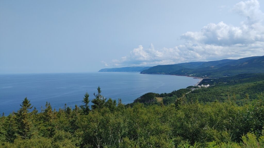
We made few stops at many lookouts we passed during our drive. Our first stop is Rusty Anchor, the best from only two restaurants in Pleasant Bay. The plan was to have a lunch over there. However, when we reached Rusty Anchor, we have to wait 10 minutes or so because the restaurant opens at 11:30 am.
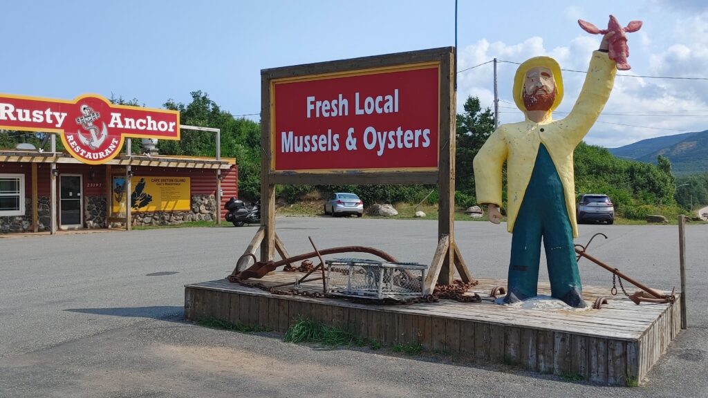
Rusty Anchor is famous for mussels and oysters. However, we did not buy one. We ordered “Cape Breton Style Fish and Chips”, “Homemade Fishcakes and Beans” and “The Burger that ate Cape Breton”. We eat at their outdoor patio backing the Gulf of St. Lawrence.
While we drove from one lookout to Pleasant Bay before, we saw there was a couple biking on a tandem bike. As you may know, the roads on Cabot Trail are up and down and many sharp turns. When we saw them, I said to my wife wow they are very strong. Surprisingly, while were waiting for our food at Rusty Anchor, the same couple came to eat and sat not too far from us. We again surprised because they (the couple at their 50’s years age) could bike such a long trip in that road condition.
Ingonish Beach
After we finished our lunch, we continued our drive. The next stop is Neils Harbour Lighthouse at New Haven, an area at northeast of Cabot Trail with population of only 300 people. There is nothing there other than the famous lighthouse and an Anglican church. We stopped there for 15 minutes to just take a picture and see the scenery along Neils harbour.
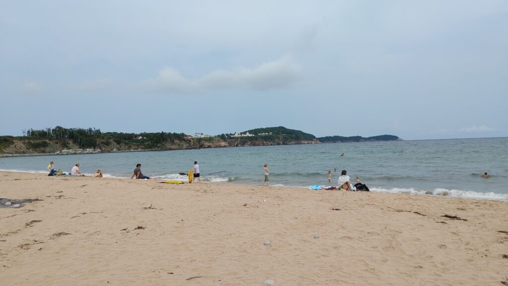
The next stop before we arrived at Baddeck is Ingonish beach. Our itinerary includes Ingonish because when we did our research, Ingonish is considered one of the popular tourist destinations in Cape Breton Island. We reached there at 2:30 pm. Initially, we could not find the beach. However, after asking the attendant at Ingonish Visitor Centre, we managed to arrive there. What we surprise is the beach is just average and not as good as promoted.
Check in at Cabot Trail Motel, Baddeck
The trip from Ingonish to our motel at Baddeck took one hour 30 minutes. Initially, we planned to have our dinner at Red Barn Gift Shop and Restaurant in Baddeck. Red Barn is a gift shop that sells crafts, clothing, jewellery, books, music etcetera and has a fast-food restaurant inside. We chose this because of its unique structure as a barn.
Because we were too lazy to go, we ended up having our dinner at the restaurant at our motel. I ordered “Traditional Liver and Onion”. My wife and my son ordered “Fettucine Alfredo” and “Haddock Burger” as well as one dozen chicken wing to share. Although the restaurant is small, the taste is good comparable to bigger restaurant.
Fifth Day - Driving from Baddeck to Cavendish, PEI
Our plan for today is going to Prince Edward Island (PEI). There are two ways to drive to PEI from Nova Scotia: by Northumberland ferry from Caribou at north of Halifax to Wood Islands in PEI or by car through Port Elgin in New Brunswick then take Confederation Bridge to Borden-Carleton in PEI.
If we start the trip from Halifax, it is much easier and faster if we use Confederation Bridge since it is closer. However, since we stayed at Baddeck in Cape Breton Island, taking ferry is the fastest way because Baddeck is closer to the ferry terminal at Caribou.
In determining which way is more cost efficient, we compared the cost of the toll (by car through Confederation Bridge) or ferry cost. One thing you need to know, normally we don’t need to pay anything when we enter PEI from either Nova Scotia or New Brunswick. We only pay when we leave PEI either through bridge or ferry.
Ferry cost between Caribou in Nova Scotia and Wood Islands in PEI is $86.00 per vehicle and the toll fee of Confederation Bridge is $50.25 per vehicle (either one payable only when re return back from PEI). Because of this, we decided to take ferry to PEI and then return from PEI through Confederation Bridge so that we only need to pay need to pay $50.25. Also, we wanted to experience the ferry riding and took breathe in fresh salt air as we take the awe-inspiring ocean view along the ride and who know, can catch a glimpse of whiles. For information, we need to return back from PEI because we would stay one night at Moncton in New Brunswick.
There is a catch though. Although taking ferry into PEI is free, if we don’t book it in advance, we need to stand by and there is no guarantee we can get a seat. This is what we did not consider it before.
On the night before, I suddenly wanted to check if the ferry schedule for the time we want to take at 11:45 am was available. To my surprise, ferry schedule for 10:00 am,11:45 am,1:30 pm were fully booked. I just realized today is Saturday. No wonder the ferry was fully booked. I discussed with my wife and my son if we want to take the 3:15 pm schedule. However, since the 3:15 pm is too late and even we wanted to, the seat may not be available if we standby unless we book it in advance and pay $86.00. We decided to just drive through Confederation Bridge to avoid any disappointment if we miss the 3:15 pm ferry if we stand by at Caribou.
From Baddeck to Confederation Bridge
I checked from Google Maps that the traveling time by car from our hotel in Baddeck to our hotel in PEI is around five hours non-stop. As you may know, we always want to stop at few places either to take a break, having lunch, or view the interesting/beautiful scenery we find along the way.
After one and half hour drive, we stopped at Antigonish to take a washroom break at McDonald. We only stopped for ten minutes and then continued our travel to Amherst, a small town at the border of Nova Scotia and New Brunswick (some people say Amherst is the gateway to Nova Scotia for travellers crossing border from New Brunswick). We stopped here to have our lunch before we crossed border to PEI through Confederation Bridge.
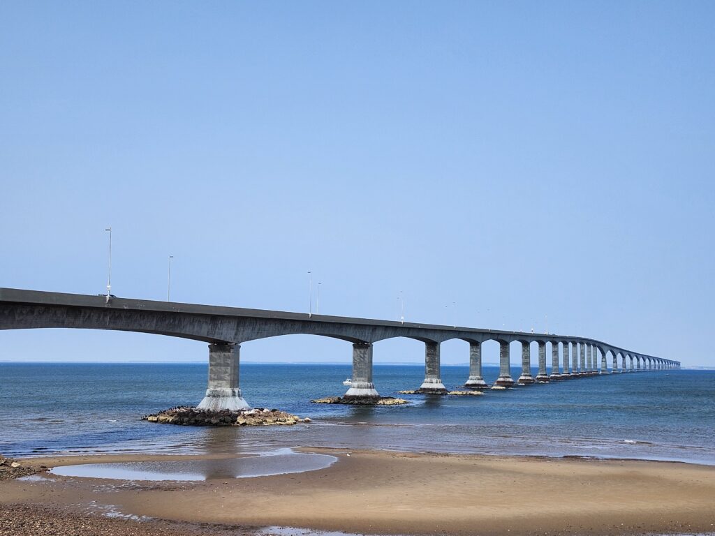
Just before we entered the Confederation Bridge, we stopped at Cape Jourimain Nature Centre, a perfect spot where we can view and take picture of the Confederation Bridge. Over there, we can see a 15.5 metres tall octagonal shape Victorian lighthouse that was built in 1869 to help ships navigate the Northumberland Strait back then. There are two hiking trails, Lighthouse Trail and Gunning Trail, both of them are a 2 km loop trail and beginners friendly trail that are easy to navigate as the surfaces are well-maintained and no uneven terrain or obstacles. As usual, as a tourist stop, there is a gift shop at Cape Jourimain where you can buy local craft and souvenirs.
Confederation Bridge to Cavendish
The Confederation Bridge was built between 1993 and 1997 to provide a high-capacity, more reliable and convenience transit between PEI and mainland Canada (i.e. New Brunswick/Nova Scotia). Before it was built, the communication and transportation between PEI and the main island is through Cape Tormentine ferry. This 12.9-kilometer-long bridge is the world’s longest bridge crossing over ice-covered water. With a maximum speed limit of 80 km/h, it takes approximately 10 minutes to travel over Confederation Bridge.
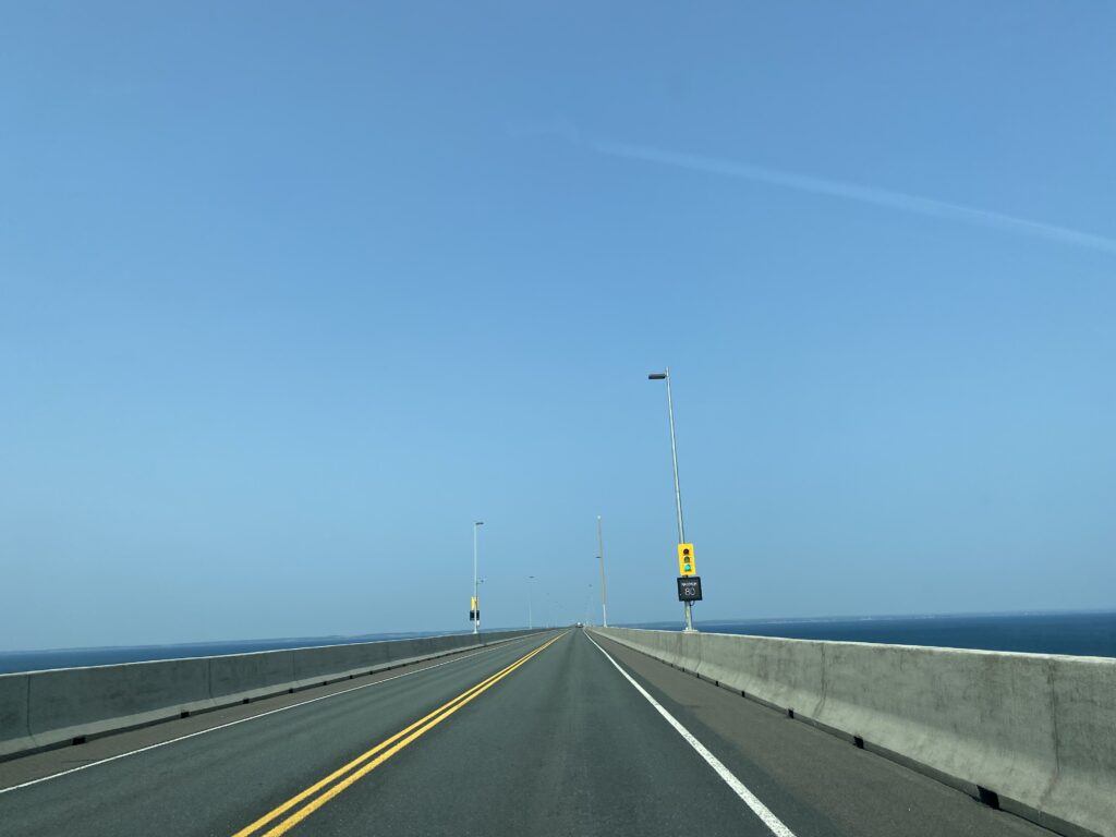
The outside view from inside the car is spectacular as we travelled over the bridge. Although we are tempted to stop in the middle to take a picture, we are not allowed to stop so that the drivers remain attentive and to reduce the potential accidents and to maintain safety of all.
On the other side of the bridge is a small town called Borden-Carleton, named after two Canadian Prime Ministers, which is considered as the gateway to PEI. We stopped here to stroll the plazas. There are shops, souvenir stores, visitor information centre, snack shop, restaurants and of course, the famous Cows, Canada’s best ice cream store.
After we bought some souvenirs, snack and drink at Borden-Carleton, we continued our journey to or destination, our booked cottage at Shining Waters Cavendish. We checked in at the cottage at 4:30 pm.
A Little Story about Anne of Green Gable book
For some people who like to watch Little House on the Prairie, the famous TV series based on Laura Ingalls book, I guess they also like to watch/read the Canadian version of similar story called Anne of Green Gables. Let me talk a little bit about Anne of Green Gables because this holds significant importance to Prince Edward Island as it has become a major driver of tourism and cultural identity of the island.
Anne of Green Gables is a classic novel by a Canadian author, Lucy Maud Montgomery. The story is set in the late 19th century about the adventures of a 11-year-old-orphan girl Anne Shirley that was raised by two middle-aged siblings in the fictional town of Avonlea in Prince Edward Island. Montgomery drew inspiration from her childhood experiences in Cavendish and its surrounding communities.
According to Wikipedia, the novel has been translated into at least 36 languages and has sold more than 50 million copies, making it one of the best-selling books worldwide in any language. The book has been adapted as films, TV series and animated and live-action TV series.
The novel’s popularity has drawn countless visitors to PEI, seeking to experience the landscapes and atmosphere that inspired the story. The novel has greatly boosted the island’s tourism industry and established PEI as a destination associated with the beloved character, Anne Shirley, of her vibrant imagination, talkative nature and passionate spirit who possesses a deep love for beauty, nature and story-telling.
There is another interesting story I need to tell where the book has a strong connection to Japan. This is primarily due to the translation of Anne of Green Gable book by a Japanese translator, Hanako Muraoka, title “Akage no An” (Red-Haired Anne) – yes Anne has long ponytail red hair – that was published in 1952. The book became a bestseller in Japan and the animated series further boosted its popularity. The story resonated with the Japanese public, especially women, seeking resilience and hope in the post-war era. Even, the book became part of the Japanese school curriculum. It used to have an almost perfect replica of Green Gables house in Cavendish, in Canadian World in Ashibetsu Japan, that attracted thousands of visitors on a summer day. Sadly though, the was abandoned and then taken over by the municipal government in 2014.
Tour to Avonlea Village and dinner at Cavendish Boardwalk
So now you have an idea right why there is a place called Avonlea Village in Cavendish. Avonlea Village is a complex in Cavendish and a quaint attraction honoring the author of Anne of Green Gables with many shops & restaurants. There are 9 eateries and 6 shops on the site that offers something for every sophisticated palate and shopper. All the establishments there are replications of houses and shops from the time of Anne of Green Gable.
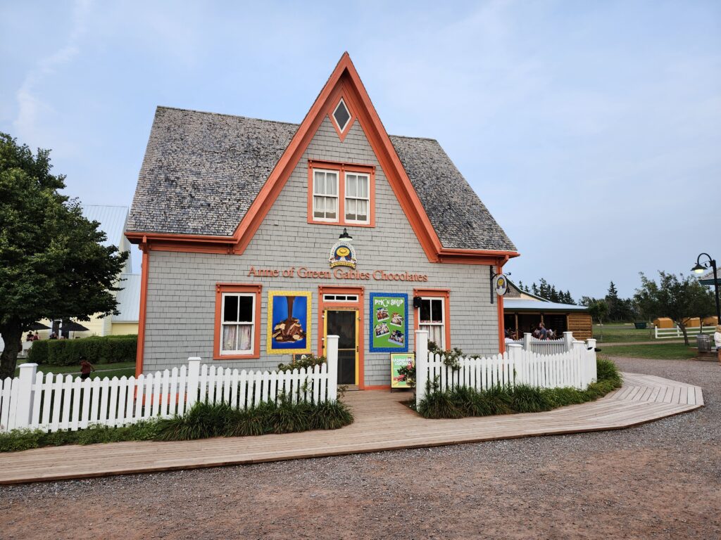
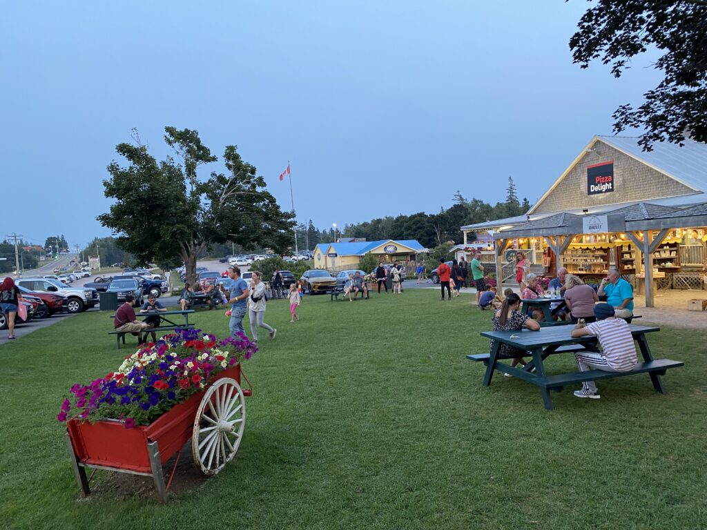
We went there in the late afternoon to stroll and browse the shops. Among others are the famous Anne of Green Gables Chocolates shop where they sell variety of chocolate treats and Anne of Green Gables themed merchandise, such as handmade chocolates, milk covered potato chips, Anne’s Raspberry Cordial (a popular drink inspired by the book), candies, maple products, souvenirs and other Anne-related gifts. As well, you can see the must have Cows factory outlet.
We then headed to Cavendish Boardwalk, a five minutes drive from Avonlea Village, the seasonal shopping complex that opens from Victoria Day until Labor Day.
Cavendish Boardwalk offers lots of great retail shopping and eating opportunities. Coastal Culture offer beach inspired stylish clothing and accessories that reflect the laid-back nature of the island. As well, Island Treasures provides a variety of local souvenirs, gifts and crafts that represent PEI. Of course, you will never miss the Cow’s ice cream store here. At the top the store, you can see the full-size cow statue overlooking the lawn of the Boardwalk.
In term of variety of foods, you will never miss to find the traditional island’s fish and chips. You can also find eateries that sell poutine, pizza, Beaver Tails, and ice cream.
Sixth Day - at Charlottetown
In the morning before we headed to Charlottetown, we dropped by Cavendish Visitor Information Centre to inquire about places to visit and direction to Charlottetown.
Green Gable Heritage Place
Then, we visited Green Gables Heritage Place, a 19th century farm and building that was initially built in 1830s by MacNeil family, relatives of Montgomery, that was later purchased by the government of Canada in 1936 that became a National Historic Site of Canada.
The Green Gables Visitor Centre, the modern and bright building, is the starting point for visitors to the Heritage Place where they can visit an exhibit hall that feature exhibits on Montgomery’s life, career development and writings. Inside the exhibit hall, there is Lego block model of Green Gables house that uses 1,800 separate Lego pieces, visual story book, some photographs taken by Montgomery. You can also find gift shop in the Visitor Center that sells anything related to Anne of Green Gable.
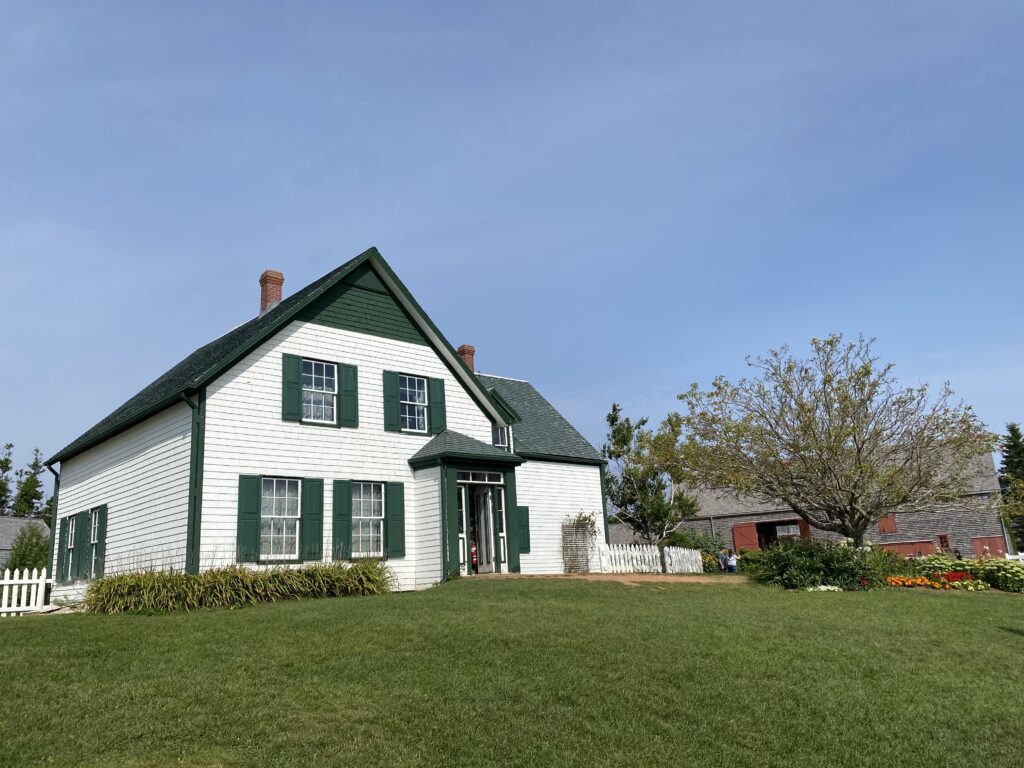
Other than the Visitor Center building, there is a barn, small café and an office. The main attraction in the Heritage Place is of course, Green Gables House, a representation of what Anne’s world might have looked like. It is a two-storey L-shaped building with the green-gabled rooftop and window shutters. The decoration inside the house is based on the descriptions found in the novel, creating a space that feels as though Anne could have lived there. The building size is about 2,400 square feet which includes five bedrooms, a dining room, sewing room, and a parlour.
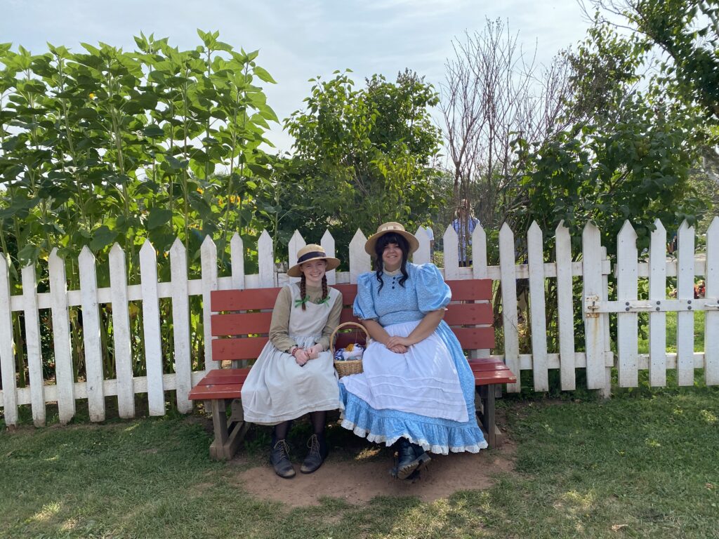
On the lawn just outside on the building, there is a red wooden chair where two young girls sat on the chair dressing looked like Anne and her best friend, Diana.
Charlottetown
After we spent almost two hours at Green Gables Heritage Place, we continued our journey to Charlottetown, the largest city in and capital of PEI. Since we only have half day to spend in the afternoon, we did not go anywhere far from Charlottetown waterfront area.
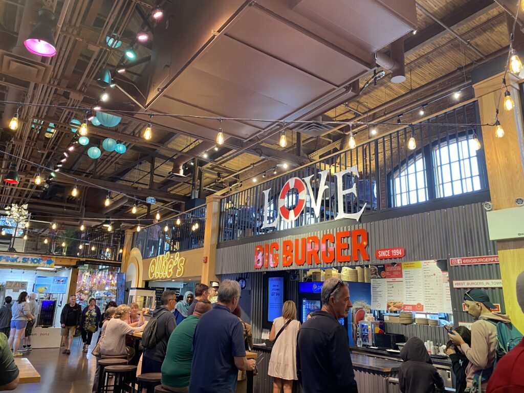
After we parked our car at a crowded parking lot, we went to Founders’ Food Hall & Market, which their website claims as a vibrant community hub to relax, connect and enjoy local shops, a café, a bar with PEI favourites and restaurants offering local ingredients globally inspired dishes! It is located in downtown Charlottetown on the east side of the harbourfront. It is a former CN repair shop that was converted into food hall. Over there you can find a variety of local vendors selling foods, drinks, crafts and souvenirs. It is like a smaller version of St. Lawrence Market in Toronto, except that you will not find anyone selling fresh produce, meat, fish in Founders’ Food Hall & Market.
On the way walking to the center of harbourfront, we passed by Confederation Landing Park, an open space park with a charming boardwalk, gazebo and shady benches. Because today is Sunday in the month of August, there is Downtown Charlottetown Farmers’ Market held in the park. The market features a variety of local vendors selling produce, baked goods, preserves and handmade crafts.
We had our lunch at Peake’ Quay Marina where we bought lobster roll, pizza and drink. Peake’ Quay Marina is a place where you can experience the eating on the water. It is a floating food court because the patios are on the top of the water can be floating in the marina slightly to either side. People can fell something exotic because they fell like eating on a cruise boat not just a normal restaurant.
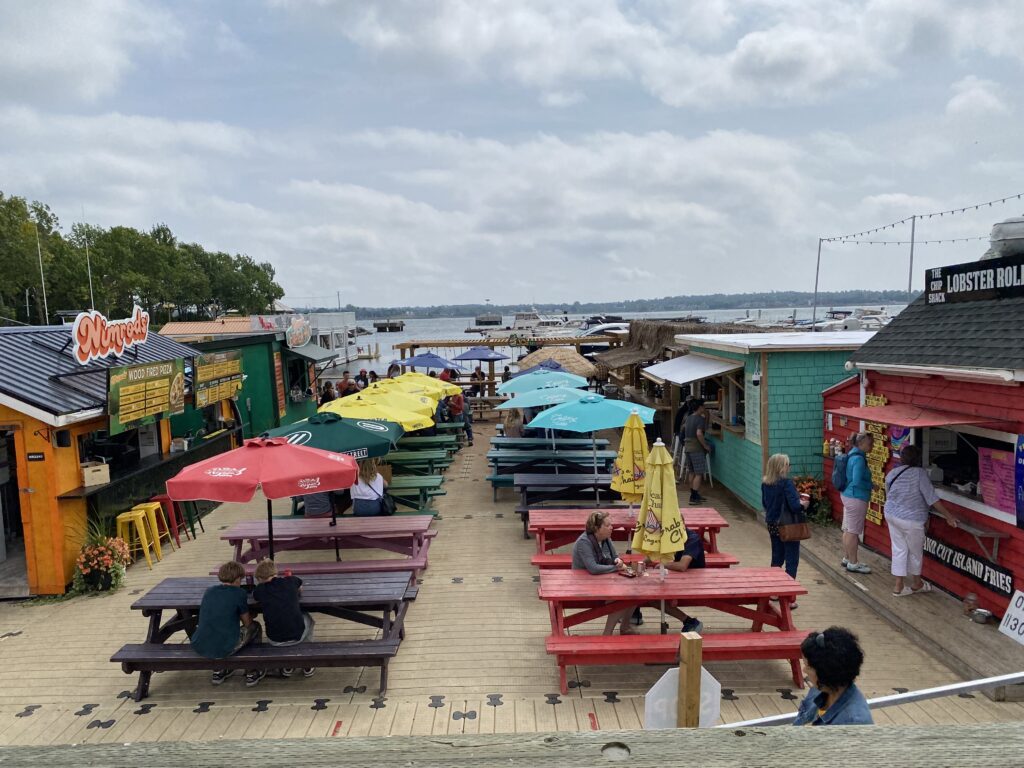
We spent the rest of the afternoon strolling and sightseeing the beauty of Charlottetown waterfront. We walked along the famous Charlottetown Boardwalk. It is a scenic and charming place to experience the vibrant atmosphere and natural beauty of PEI’s capital. Along the waterfront, this picturesque promenade is a perfect spot to walk leisurely while viewing the harbour and the surrounding landscape. Over here, you will find a lot of people strolling, jogging, cycling or simply sitting on the benches enjoying the scenery. There are numerous shops, eateries and café along the way making it a great spot to enjoy some refreshment and take a break. During Summer time, you can find street performers singing, playing musical instrument or performing stunts.
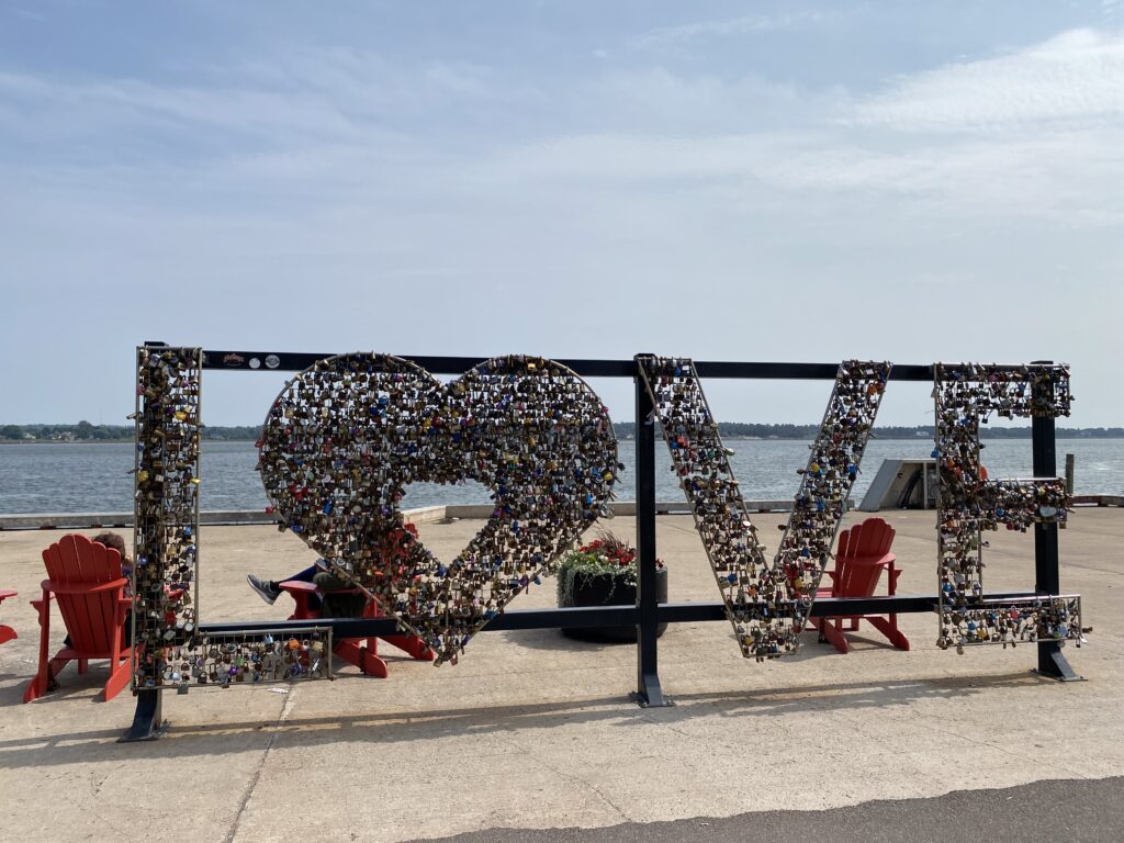
At the bottom of the Queen Street in a former Queen’s Wharf, you will find two installations that catch visitors’ eye. The first one is the “large red numbers” depicting the year (i.e. 2024 of this year) and a giant, steel sculpture that spells out LOVE.

On the LOVE sculpture, people can attach padlock inside and along the letter LOVE and lock it to show and symbolize their love to other. Some people inscribe their sweetheart’s initial or name on the padlock and the padlock key is throwed away (often on the water) to symbolize unbreakable love.
Because of these two installations, the Queen’s Wharf became one of the must stop destination in Charlottetown and has become a favorite photo opportunity for special occasion no mater what time of year it is.
Dinner at Fisherman’s Wharf
In the evening after we came back from Charlottetown Waterfront, we had our dinner at Fisherman’s Wharf Lobster Supper. It is a famous family restaurant with 400 seats located in North Rustico (not too far from Cavendish) where you can order lobster for dinner with 60 ft salad bar and all-you-can-eat mussels and seafood chowder. Aside from this, they also offer a la carte menu. As well, they have a large gift shop with a great selection of souvenirs and gifts.

Seventh Day - From PEI to Hopewell Rock
This morning, we checked out from our cottage at Cavendish and the plan was to head away directly to Hopewell Rocks Provincial Park at New Brunswick. From the Google Maps, we noted that the distance from our cottage is 19 km and the travelling time by car is about 2.5 hours.
We arrived at Hopewell Rocks parking lot at 11:30 am. The weather was very hot. We saw a lot of people had already been there and the parking lot was almost full. We had our lunch at High Tide Restaurant inside Hopewell Rocks Provincial Park. It is a full-service restaurant focusing on fresh and local flavours from local producers. The dining deck overlooks an incredible tidal flat providing a refreshment, rest and good vibe while enjoying the food and the sea breeze.
About Hopewell Rocks
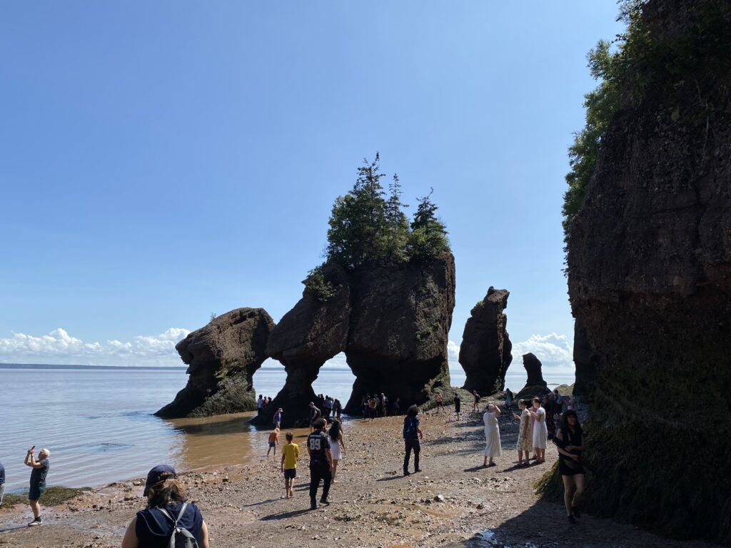
After we finished our lunch, we headed directly to the Flowerpot Rocks. There are many rock formations over there, the biggest and most famous one is Flowerpot Rocks because the formations are large and resembling the shape of flowerpot. Because Flowerpot Rocks is the most famous one, people refer it as just Rockwell Rocks. These rocks stand between 12-21 metres tall. During periods of low tide, people can walk along 2 km of beach and explore several coves. At high tide, the top of the rocks can still be visible from the trails above. However, you can join kayaking tour while on the high tide.
Depending on when you are there, low tide and high tide can be at different times on different day. Low tide and high tide alternate approximately every 6 hours. For example, if low tide on a day is at 8:00 am, the next high tide will be at 2:00 pm and the nest low tide is at 8:00 pm and so on. When we arrived there, the low tide time has passed and the water started to cover the beach little by little.
We went to the lower ground of the rocks to walk around, get a real feel and take pictures closer to Hopewell Rocks. Because the ground is sand covered by rising water from the tide, it became muddy and yellowish color. Hopewell Rock is spectacular nature creation that becomes an iconic place for many people to visit and dream. The Bay of Fundy where Hopewell Rocks is located is home to the world’s highest tides. The tidal range in the Bay of Fundy can reach up to 16 meters high.
Last Day - Return to Toronto
After we are done with our breakfast at the hotel in Moncton, we said goodbye to New Brunswick, Nova Scotia and PEI as we finished our fabulous trip to Canada’s East Coast.
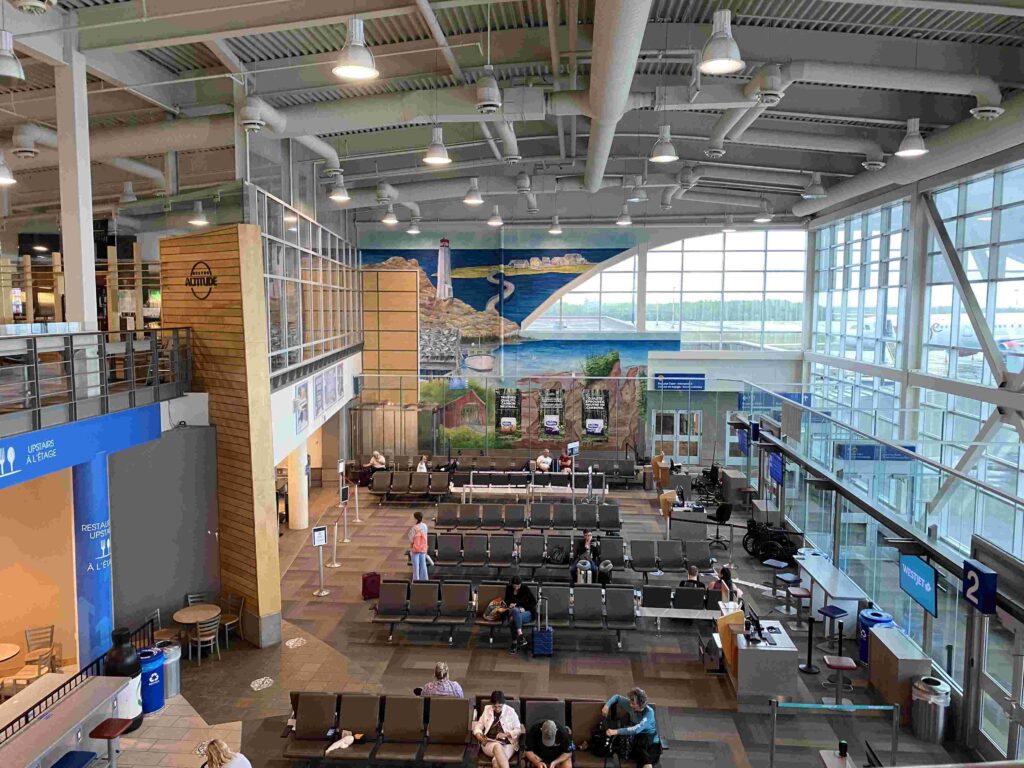
We drove car to Greater Moncton Romeo LeBlanc International Airport located not too far from downtown Moncton and dropped off our rented car at the airport. The airport is pretty small relative to other airports in Canada. There is only one terminal and area for departure and arrival hall. Everyone is waiting in the same one waiting area. Although it is called international airport, I did not see any international airline either departing from or arriving at Romeo LeBlanc airport.
